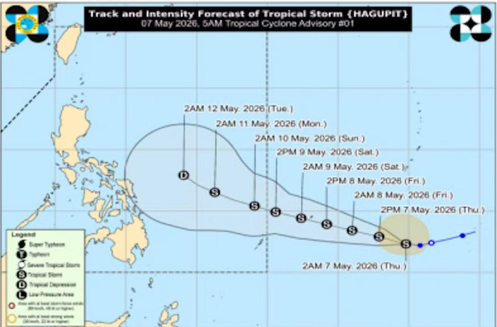
TROPICAL storm “Hagupit” has intensified as it continued to move closer to the Philippines, the Philippine Atmospheric Geophysical and Astronomical Services Administration (PAGASA) on Friday said.
In tropical storm advisory 5 Issued at 11 p.m. Friday, May 8, 2026, the center of “Hagupit” was estimated based on all available data at 1,260 km East of Northeastern Mindanao (outside the Philippine Area of Responsibility),
“Hagupit” was packing maximum sustained winds of 85 kilometers per hour (kph), with gustiness of up to 105 kph.
It is moving Westward at 15 km/h.
“Hagupit” is forecast to move west northwestward during the majority of the forecast period and will remain over the Philippine Sea, far from land.
It will enter the Philippine Area of Responsibility (PAR) on Saturday afternoon or evening.
However, an earlier PAR entry is not ruled out.
Once “Hagupit” enters the PAR, it will be given the local name Caloy.
 ASEAN OKAYS MARITIME CENTRE IN PH TO ENSURE FREEDOM OF NAVIGATION IN SOUTHEAST ASIA – MARCOS
  7 PINOY SEAMEN HURT IN IRAN DRONE ATTACK IN STRAIT OF HORMUZ — DFA
  20 FILIPINO HUMAN TRAFFICKING VICTIMS FROM CAMBODIA SAFELY REPATRIATED
  BOC DESTROYS OVER 6,000 REAMS OF SEIZED CIGARETTES
  PASS ‘GINHAWA’ BILL TO BOOST MIDDLE CLASS TAKE-HOME PAY – GATCHALIAN
  LACSON: BLUE RIBBON TO TRANSMIT FLOOD CONTROL EVIDENCE TO OMBUDSMAN, DOJ
  CIDG SMASHES 2 STL BOOKIES IN TARLAC
  TROPICAL STORM ‘HAGUPIT’ INTENSIFIES, TO ENTER PAR SATURDAY