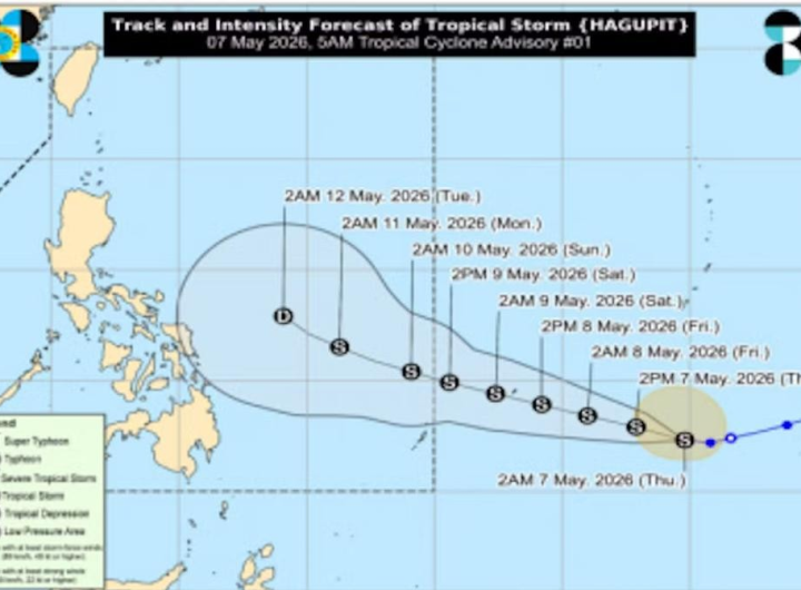
THE Philippine Atmospheric, Geophysical and Astronomical Services Administration (PAGASA) said another tropical storm was expected to enter the Philippine area of responsibility (PAR) on Saturday night or early Sunday morning.
PAGASA said the typhoon, with international name “Kong Rey” will be named “Leon” once it entered the PAR.
The state weather bureau said it could reach typhoon category by Monday.
According to PAGASA, the tropical cyclone is expected to intensify gradually and may reach severe tropical storm category on Sunday and typhoon status on Monday.
Once “Leon” reaches the PAR, the weather bureau said the storm’s path would be far from the Philippine landmass, but its rain bands could affect extreme northern Luzon.
In its 4 p.m. weather bulletin on Saturday, “Leon” was 1,825 kilometers east of Central Luzon, with maximum sustained winds of 65 km per hour (kph) near the center and gusts of up to 80 kph, with its movement being west-northwestward at 25 kph.
Storm signals for Kristine were lifted on Friday following its exit from the PAR.
“Kristine will continue moving westward over the West Philippine Sea until Saturday, loop counterclockwise on Sunday and Monday, then move eastward for the remainder of the forecast period.,” PAGASA said.
However, the state weather bureau said this scenario heavily depends on the behavior of the tropical cyclone east of the PAR region and the behavior of other synoptic weather systems surrounding Kristine while over the West Philippine Sea.

 TROPICAL STORM ‘HAGUPIT’ INTENSIFIES, TO ENTER PAR SATURDAY
  ASEAN OKAYS MARITIME CENTRE IN PH TO ENSURE FREEDOM OF NAVIGATION IN SOUTHEAST ASIA – MARCOS
  7 PINOY SEAMEN HURT IN IRAN DRONE ATTACK IN STRAIT OF HORMUZ — DFA
  20 FILIPINO HUMAN TRAFFICKING VICTIMS FROM CAMBODIA SAFELY REPATRIATED
  BOC DESTROYS OVER 6,000 REAMS OF SEIZED CIGARETTES
  PASS ‘GINHAWA’ BILL TO BOOST MIDDLE CLASS TAKE-HOME PAY – GATCHALIAN
  CIDG SMASHES 2 STL BOOKIES IN TARLAC